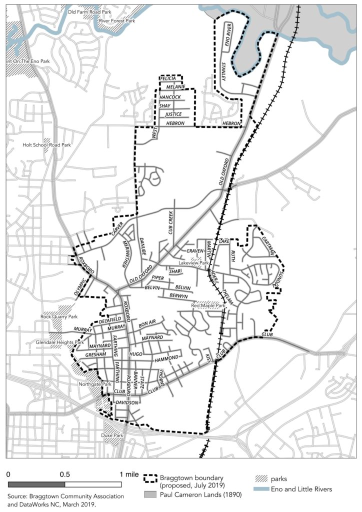
The Bragtown Community Association’s boundary: This area is inclusive of several important locations: the crossroads of Old Oxford Highway and Roxboro Road, which was called “Bragtown” on maps as old as 1887; the area surrounding the rail line, which soon after enslaved people were freed from the Cameron Plantation became a primary route from Stagville to the newly-free Black community; and the historic business district of Bragtown anchored at Roxboro Road and Club Boulevard.
*
In 2018 when the Bragtown Community Association had been actively organizing around new bylaws, the group came to DataWorks with the request to map the community boundary. For us, this was an effort to understand what space the community members identify with, but we also needed to make a correction. For several years the public maps describing the extent of Bragtown looked like this:
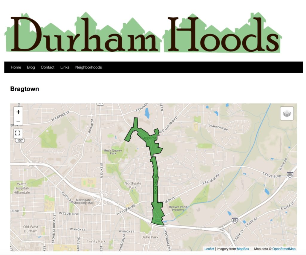
Durham Hoods, a community-responsive website managed by a private individual, incorporates only the properties facing Roxboro and Avondale Drive. This is the area included in the City of Durham’s Economic Development Corridors and on one hand it properly anchors the community at the intersections of Roxboro Street with Club Boulevard and Old Oxford Highway. But it includes no residential properties.
Along with missing the residents of Bragtown, there is a long history not accounted for in the Durham Hoods boundary. The oldest available detailed map of the area is from 1887 and it features Bragtown (one “g”) at the intersection of what is now Roxboro Road and Old Oxford Highway. The Stagville Plantation is also featured on this map (with two “g”s).
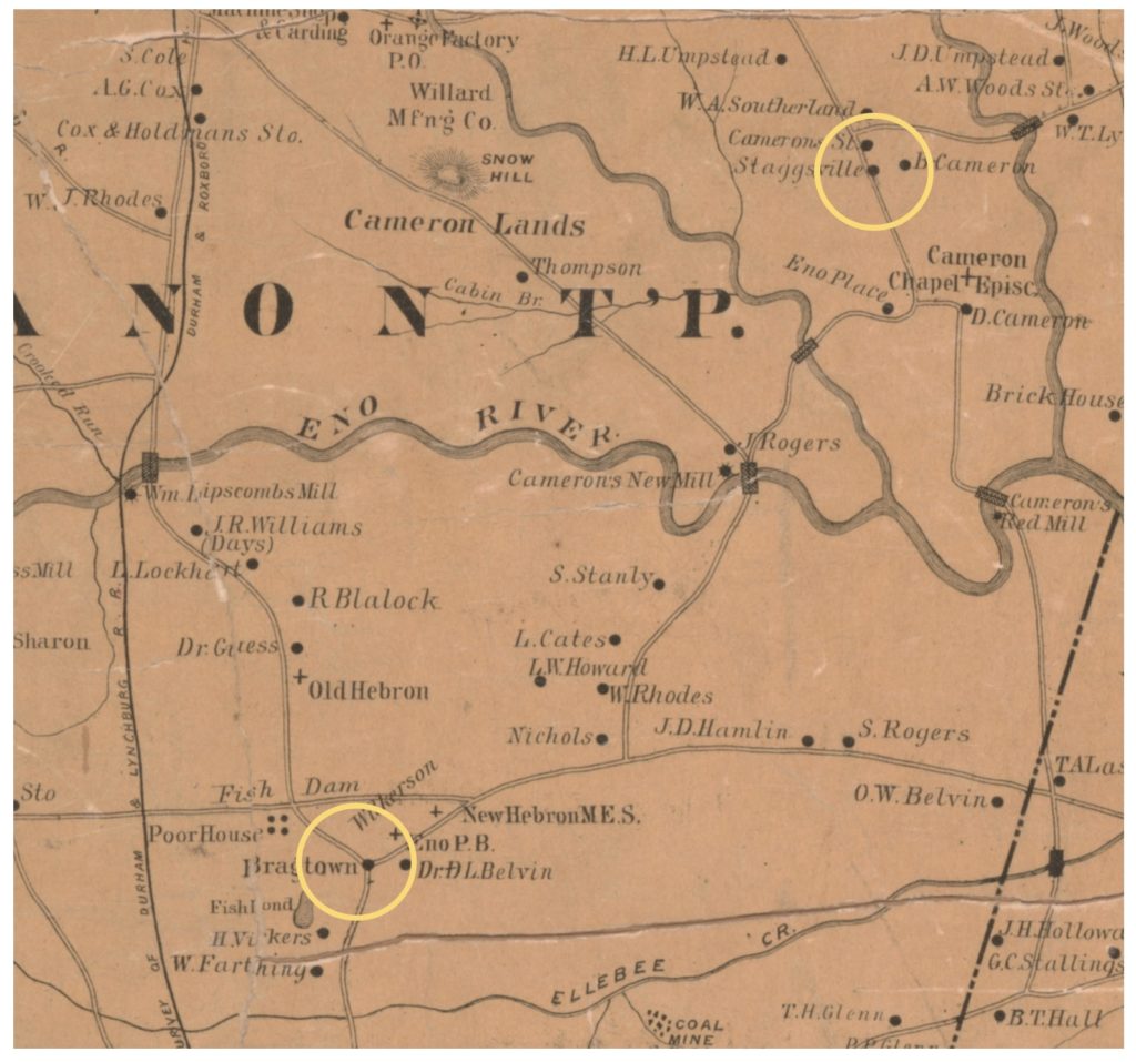
The story of Bragtown shared by neighborhood elders is of an unincorporated community that had its own mayor; a self-reliant Black community that created its own library when a Fence Road neighbor dedicated their home for a community collection; a free community of families that left the Cameron plantation lands, walking the rail road tracks to a fresh start during Reconstruction. This history needed to be referenced in the map as well.
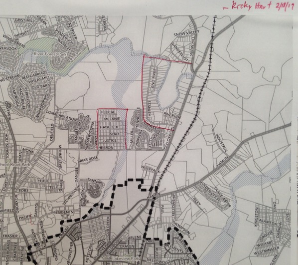
DataWorks joined with members of the community in August 2018, and began the process of crafting this map. Participants included residents whose families have been in Bragtown for generations, since long before 1865. Each contributor circled their home on a large printed map and marked the edges of the neighborhood as they have known them. The map came to each community meeting over the following year.
The area does include other self-identified communities, some established earlier in the 20th century and some subdivided in recent years. What unites them is their origin in the broader Bragtown community which long precedes the area’s annexation by the City of Durham in the late 1950s.
Going forward, the Bragtown Community Association will use this boundary in its work, organizing to preserve the past and determine the future. Concerns the group is working on right now include the preservation of community and family history in the face of rapid gentrification; improvement to park facilities and housing; and continued development of gardens and food production in Bragtown. To learn more about their work or to reach out, visit their webpage.
DataWorks will incorporate this boundary in its work, and continue collaborating with Bragtown Community Association. Starting in 2020, this boundary will also be included in the Neighborhood Compass.
*
John Killeen is the executive director of DataWorks NC. Credit for this writing and the process it describes is shared with Vannessa Mason Evans, the Bragtown Community Association, and Ricky Hart.